
Karteikarten (10)
Karteikarte 1 von 10
OCR-Text
–
–
–
–
–
Extrahierte Daten
- Urheber:
- –
- Ort:
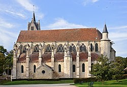
- La Chapelle-sous-Crecy, Notre-Dame-de-L'Assomption
- Titel:
- Notre-Dame-de-L'Assomption (Grundriß, Querschnitt, Höhenplan des Triforiums)
- Material:
- –
- Kategorie:
- Architektur: Kirche
- Inv.-Nr.:
- 19100026; ZI457675
- Fotograf:
- Suckale, Robert; Zentralinstitut für Kunstgeschichte, Photothek
Geomatch - Verknüpfung mit Normdaten (Orte) · 1
457675
Gebäude Objekt / Institution
Adresse & Koordinaten · nur Region
- Ort:
- La Chapelle-sous-Crecy
- Region:
- Île-de-France
- Land:
- Frankreich
Bewertung 95 % · production
The building name 'Notre-Dame-de-L'Assomption' matches the candidate article 'Notre-Dame-de-l’Assomption (Crécy-la-Chapelle)', and the address 'La Chapelle-sous-Crecy' is geographically adjacent to Crécy-la-Chapelle (distance 0.50km), indicating the photo archive likely mislabeled the specific commune or refers to the prominent church in the nearby town of Crécy-la-Chapelle, which is the only specific church candidate provided.
Datenquelle: Digitales Inventar (HiDA) · 1
457675
- Werktyp:
- Kirche
- Gattung:
- Architektur
- Datierung:
- 1201/1250
- Institution:
- Notre-Dame-de-L'Assomption
- Standorttyp:
- architecture
- Bildarchiv:
- Bildarchiv: Caisse Nationale des Monuments Historiques, Archives Photographiques, M.H.202.672
- Verwalter:
- Caisse Nationale des Monuments Historiques, Archives Photographiques
- Inhalt:
- Grundriß, Querschnitt, Höhenplan des Triforiums
- Aufnahme-Nr.:
- M.H.202.672
- Zugangsdatum:
- 2008.05
- Zugangsart:
- Geschenk
- Aufnahmeherkunft:
- Suckale, Robert
- HIDA-ID:
- 184669
Maschinell aufbereitete Daten
- Kategorie:
- Architektur
- Zeitraum:
- 1201/1250
- Stadt (normiert):
- La Chapelle-sous-Crecy
- Land:
- Frankreich
- Institution (normiert):
- Notre-Dame-de-L'Assomption
- Einrichtungstyp:
- Bau / in situ
ZI-INVB-HIDA9-024_01