
Karteikarten (10)
Karteikarte 1 von 10
OCR-Text
1489 u.
Umbau 1854
Umbau 1854
Türkenfeld
(L.Kr.Fürsten-
feldbruck)
Pfarrkirche
St. Maria
(L.Kr.Fürsten-
feldbruck)
Pfarrkirche
St. Maria
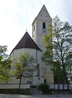
Aussenansicht von O.
Arch. dtsch.
63763
63763
F.:Dr. Schlegel
Extrahierte Daten
- Urheber:
- –
- Ort:
- Türkenfeld, Pfarrkirche St. Maria
- Titel:
- Aussenansicht von O.
- Material:
- –
- Kategorie:
- Architektur / Deutschland
- Inv.-Nr.:
- 063763
- Fotograf:
- Dr. Schlegel
Datenquelle: manuelle Erfassung Orte · 1
063763
- Titel:
- Katholische Pfarrkirche Sankt Mariä Himmelfahrt
- Titel (Quelle):
- Türkenfeld: Katholische Pfarrkirche Sankt Mariä Himmelfahrt
- Beschreibung:
- Außenansicht von Osten (Umbau 1766-1889)
- Entstehung von:
- 1489
- Aufnahme von:
- 1930
- Aufnahme bis:
- 1954
- Fotograf:
- Arthur Schlegel
- Ort:
- Türkenfeld
- Ort (Quelle):
- Türkenfeld
- Gattung:
- Architektur
- Lizenz:
Geomatch - Verknüpfung mit Normdaten (Orte) · 1
039_01
Gebäude Objekt / Institution
Adresse & Koordinaten · aus Wikidata
Schloßweg 1
82299 Türkenfeld, Deutschland
48.10900, 11.08451 (address)
© OpenStreetMap-Mitwirkende Größere Karte
Bewertung 95 % · production
The article 'Mariä Himmelfahrt (Türkenfeld)' describes the Catholic parish church in Türkenfeld, which corresponds to the user's query for 'Pfarrkirche St. Maria' in the same location, as local churches are often referred to by their dedication (St. Maria) even if the formal title is Mariä Himmelfahrt.
Maschinell aufbereitete Daten
- Kategorie:
- Architektur
- Stadt (normiert):
- Türkenfeld
- Land:
- Deutschland
- Institution (normiert):
- Pfarrkirche St. Maria
- Einrichtungstyp:
- Bau / in situ
Verknüpfte Bilder
ZI-INVB-PH24-039_01