
Karteikarten (8)
Karteikarte 1 von 8
OCR-Text
Koblenz
ehem.kurfürstl.
Schloß
ehem.kurfürstl.
Schloß
–
Fassade
Arch. dtsch.
116481
116481
F: Staatl.Bildst.
Extrahierte Daten
- Urheber:
- –
- Ort:
- Koblenz, ehem.kurfürstl. Schloß
- Titel:
- Fassade
- Material:
- –
- Kategorie:
- Architektur / Deutschland
- Inv.-Nr.:
- 116481
- Fotograf:
- Staatl.Bildst.
Datenquelle: manuelle Erfassung Orte · 1
116481
- Titel:
- Neues Schloss
- Titel (Quelle):
- Koblenz: Neues Schloss
- Beschreibung:
- Westfassade
- Urheber:
- Antoine-François Peyre
- Entstehung von:
- 1777
- Entstehung bis:
- 1793
- Aufnahme von:
- 1920
- Aufnahme bis:
- 1940
- Fotograf:
- Staatliche Bildstelle Berlin
- Ort:
- Koblenz
- Ort (Quelle):
- Koblenz
- Gattung:
- Architektur
Geomatch - Verknüpfung mit Normdaten (Orte) · 1
116481
Gebäude Objekt / Institution
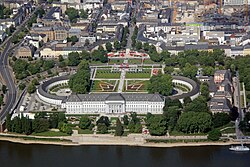
Adresse & Koordinaten · aus Wikidata
Neustadt
56068 Koblenz, Deutschland
50.35639, 7.59936 (street)
© OpenStreetMap-Mitwirkende Größere Karte
Bewertung 95 % · topd-revised
The Kurfürstliches Schloss in Koblenz is historically and commonly known as the 'Neues Schloss' (New Castle) to distinguish it from the older Festung Ehrenbreitstein or other structures, and it is the only major castle candidate located in Koblenz.
Maschinell aufbereitete Daten
- Kategorie:
- Architektur
- Stadt (normiert):
- Koblenz
- Land:
- Deutschland
- Institution (normiert):
- ehem.kurfürstl. Schloß
- Einrichtungstyp:
- Bau / in situ
Verknüpfte Bilder
ZI-INVB-PH46-238_01