
Karteikarten (8)
Karteikarte 1 von 8
OCR-Text
J. Bougier
1629-34
1629-34
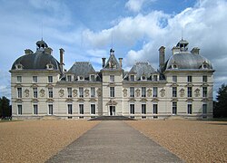
Cheverny
Schloß
Schloß
Schmalseite u. Gartenfront
160 073
Foto Marburg
170 577
170 577
Extrahierte Daten
- Urheber:
- J. Bougier
- Ort:
- Cheverny, Schloß
- Titel:
- Schmalseite u. Gartenfront
- Material:
- –
- Kategorie:
- –
- Inv.-Nr.:
- 160073
- Fotograf:
- Marburg, 170 577
Kurzinventar · 1
ZI-INVB-KPH-017 · Inv.-Nr. 159995 – 160241
- Herkunft:
- Marburg
- Zugangsart:
- –
- Datum:
- 1973
Geomatch - Verknüpfung mit Normdaten (Orte) · 1
132_01
Gebäude Objekt / Institution
Adresse & Koordinaten · nur Region
- Ort:
- Cheverny
- Region:
- Zentrum
- Land:
- Frankreich
Bewertung 95 % · production
The building candidate 'Schloss Cheverny' exactly matches the address 'Cheverny' and describes the specific château located in that French commune, whereas other candidates refer to different locations or are merely the municipality article itself.
Verknüpfung mit Normdaten (Künstler) · 1
160073
1757–1833Jean-Baptiste De Bouge
Bouge, Jean-Baptiste de
- Beschreibung:
- Belgian cartographer (1757–1833) (en) WD
- Wikidata:
- Q27899037
- GND:
- 1011432986
- VIAF:
- 84717258
- ISNI:
- 0000000119520039
- Wikipedia (en):
- https://en.wikipedia.org/wiki/Jean-Baptiste_de_Bouge
Jean-Baptiste de Bouge (1757–1833) was a Belgian cartographer whose career spanned decades of major political upheaval, his country in turn being (part of) the Austrian Netherlands, the United Belgian States, the French First Republic, the Napoleonic Empire, and the United Kingdom of the Netherlands, before becoming the Kingdom of Belgium. He often worked with the cartographic engraver Philippe Joseph Maillart. WP Wikipedia (en), Stand 15.10.2026 · CC BY-SA 4.0
card_id disagree
Bewertung hoch 0.61
Maschinell aufbereitete Daten
- Kategorie:
- Architektur KI-Vorhersage
- Stadt (normiert):
- Cheverny
- Land:
- Frankreich
- Institution (normiert):
- Schloß
- Einrichtungstyp:
- Bau / in situ
ZI-INVB-PH54-132_01