
Karteikarten (8)
Karteikarte 1 von 8
OCR-Text
La Flèche
Prytaneum
(ehem. Jesuitenkl)
Prytaneum
(ehem. Jesuitenkl)
–
Kirche, Lgh., N-Wand, ö.Joch v.S
163 270
Foto Marburg
169 374
169 374
Extrahierte Daten
- Urheber:
- –
- Ort:
- La Flèche, Prytaneum (ehem. Jesuitenkl)
- Titel:
- Kirche, Lgh., N-Wand, ö.Joch v.S
- Material:
- –
- Kategorie:
- –
- Inv.-Nr.:
- 163270
- Fotograf:
- Marburg 169 374
Kurzinventar · 1
ZI-INVB-KPH-018 · Inv.-Nr. 163218 – 163452
- Herkunft:
- Marburg FM 1207
- Zugangsart:
- –
- Datum:
- 1973
Geomatch - Verknüpfung mit Normdaten (Orte) · 1
460_01
Gebäude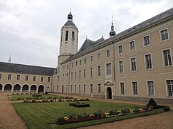
Adresse & Koordinaten · aus Wikidata
Rue du Collège
72200 La Flèche, Frankreich
47.70044, -0.07315 (street)
© OpenStreetMap-Mitwirkende Größere Karte
Bewertung 95 % · backfill
The article 'Prytanée national militaire' explicitly describes the building located in La Flèche, founded by Henri IV and associated with the Jesuits, which matches the building name and photo evidence perfectly.
Maschinell aufbereitete Daten
- Kategorie:
- Architektur regelbasiert
- Stadt (normiert):
- La Flèche
- Land:
- Frankreich
- Institution (normiert):
- Prytaneum (ehemaliges Jesuitenkloster)
- Einrichtungstyp:
- Bau / in situ
Original: Prytaneum (ehem. Jesuitenkl)
ZI-INVB-PH54-460_01