
Karteikarten (8)
Karteikarte 1 von 8
OCR-Text
–
Paris
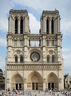
Notre-Dame
Notre-Dame
innen: s.Chorumgang;
1.m.Pfl.v.W, v.NO (S1 0) -
westlichster Pfl. (S1 0) -
dto.
S-Wand, 1.Pfl.v.W, v.NO (S2 0) -
Kpt.zw.1.u.2.J.v.W (S2 0)
1.m.Pfl.v.W, v.NO (S1 0) -
westlichster Pfl. (S1 0) -
dto.
S-Wand, 1.Pfl.v.W, v.NO (S2 0) -
Kpt.zw.1.u.2.J.v.W (S2 0)
197 137
138
139
140
141
138
139
140
141
Foto Marburg 171878
171879
171880
171904
171903
171879
171880
171904
171903
Extrahierte Daten
- Urheber:
- –
- Ort:
- Paris, Notre-Dame
- Titel:
- innen: s.Chorumgang; 1.m.Pfl.v.W, v.NO (S1 0) - westlichster Pfl. (S1 0) - dto. S-Wand, 1.Pfl.v.W, v.NO (S2 0) - Kpt.zw.1.u.2.J.v.W (S2 0)
- Material:
- –
- Kategorie:
- –
- Inv.-Nr.:
- 197137, 197138, 197139, 197140, 197141
- Fotograf:
- Marburg 171878 171879 171880 171904 171903
Kurzinventar · 1
ZI-INVB-KPH-025 · Inv.-Nr. 196699 – 197812
- Herkunft:
- Foto Marbg.
- Zugangsart:
- –
- Datum:
- 1976
Geomatch - Verknüpfung mit Normdaten (Orte) · 1
279_01
Gebäude Objekt / Institution
Adresse & Koordinaten · aus Wikidata
Parvis Notre-Dame - Place Jean-Paul II 6
75004 Paris, Frankreich
48.85294, 2.35005 (address)
© OpenStreetMap-Mitwirkende Größere Karte
Bewertung 100 % · production
The building name 'Notre-Dame' in Paris clearly refers to the famous cathedral, which is described by the Wikipedia article 'Kathedrale Notre-Dame de Paris' (index 4), while other candidates refer to different churches, metro stations, or districts.
Maschinell aufbereitete Daten
- Kategorie:
- Architektur KI-Vorhersage
- Stadt (normiert):
- Paris
- Land:
- Frankreich
- Institution (normiert):
- Notre-Dame
- Einrichtungstyp:
- Bau / in situ
ZI-INVB-PH60-279_01