
Karteikarten (8)
Karteikarte 1 von 8
OCR-Text
–
Straubing
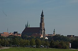
St. Jakob
St. Jakob
innen:
- Ansicht von SW, Lgh.
- südl. SS, von O
- Ansicht von SW, Lgh.
- südl. SS, von O
344 390
344 391
344 391
Ft.Marbg. 61828, Aufn. 1932
dto. 61829 a, Aufn. 1932
dto. 61829 a, Aufn. 1932
Extrahierte Daten
- Urheber:
- –
- Ort:
- Straubing, St. Jakob
- Titel:
- Ansicht von SW, Lgh.; südl. SS, von O
- Material:
- –
- Kategorie:
- –
- Inv.-Nr.:
- 344390, 344391
- Fotograf:
- Marbg. 61828, Aufn. 1932; Marbg. 61829 a, Aufn. 1932
Kurzinventar · 1
ZI-INVB-KPH-130 · Inv.-Nr. 344353 – 344409
- Herkunft:
- Ft. Marburg
- Zugangsart:
- –
- Datum:
- 1989
- Inhalt:
- Straubing
Geomatch - Verknüpfung mit Normdaten (Orte) · 1
366_01
Gebäude Objekt / Institution
Adresse & Koordinaten · aus Wikidata
Pfarrplatz 21
94315 Straubing, Deutschland
48.88259, 12.56797 (address)
© OpenStreetMap-Mitwirkende Größere Karte
Bewertung 95 % · backfill
The candidate 'Basilika St. Jakob (Straubing)' explicitly matches the building name and the specific city location provided in the address, whereas other candidates refer to different cities or unrelated entities.
Maschinell aufbereitete Daten
- Kategorie:
- Architektur KI-Vorhersage
- Stadt (normiert):
- Straubing
- Land:
- Deutschland
- Institution (normiert):
- St. Jakob
- Einrichtungstyp:
- Bau / in situ
Verknüpfte Bilder
2 Bilder
ZI-INVB-PH84-366_01