
Karteikarten (8)
Karteikarte 1 von 8
OCR-Text
Berlin
Schloß Charlottenburg
Schloß Charlottenburg
–
Grundriß
385 970
–
Extrahierte Daten
- Urheber:
- –
- Ort:
- Berlin, Schloß Charlottenburg
- Titel:
- Grundriß
- Material:
- –
- Kategorie:
- –
- Inv.-Nr.:
- 385970
- Fotograf:
- –
Kurzinventar · 1
ZI-INVB-KPH-175 · Inv.-Nr. 385962 – 386007
- Herkunft:
- Gesch. Braunfels
- Zugangsart:
- Geschenk
- Datum:
- 1995
- Inhalt:
- Versch.
Datenquelle: manuelle Erfassung Orte · 1
385970
- Titel:
- Schloss Charlottenburg
- Titel (Quelle):
- Berlin: Schloss Charlottenburg
- Beschreibung:
- Grundriss (aktuelle Anlage)
- Entstehung von:
- 1695
- Entstehung bis:
- 1791
- Aufnahme von:
- 1920
- Aufnahme bis:
- 1987
- Ort:
- Berlin-Charlottenburg
- Ort (Quelle):
- Berlin-Charlottenburg
- Gattung:
- Architektur
Geomatch - Verknüpfung mit Normdaten (Orte) · 1
385970
Gebäude Objekt / Institution
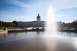
Adresse & Koordinaten · aus Wikidata
Spandauer Damm 10-22
14059 Berlin, Deutschland
52.52132, 13.29923 (address)
© OpenStreetMap-Mitwirkende Größere Karte
Bewertung 100 % · topd-revised
The article 'Schloss Charlottenburg' accurately describes the specific building named in the query, located in the correct quarter (Berlin-Charlottenburg), and matches the architectural details and history mentioned in the photo evidence.
Maschinell aufbereitete Daten
- Kategorie:
- Architektur regelbasiert
- Stadt (normiert):
- Berlin
- Land:
- Deutschland
- Institution (normiert):
- Schloß Charlottenburg
- Einrichtungstyp:
- Bau / in situ
Verknüpfte Bilder
ZI-INVB-PH89-499_01