
Karteikarten (8)
Karteikarte 1 von 8
OCR-Text
–
München
Hauptstaatsarchiv
Abt. IV Kriegsar.
Plansammlung
München 165
Hauptstaatsarchiv
Abt. IV Kriegsar.
Plansammlung
München 165
Kriegsministerium
Spies 1829
712x513mm, Feder
Spies 1829
712x513mm, Feder
Arch.
Th 211928
Th 211928
Foto: Haupt-
staatsarchiv
staatsarchiv
Extrahierte Daten
- Urheber:
- –
- Ort:
- München, Hauptstaatsarchiv Abt. IV Kriegsar. Plansammlung München 165
- Titel:
- Kriegsministerium
- Material:
- Feder
- Kategorie:
- Architektur
- Inv.-Nr.:
- Th211928
- Fotograf:
- Hauptstaatsarchiv
Kurzinventar · 1
ZI-INVB-KTHY-052 · Inv.-Nr. Th211872 – Th212001
- Herkunft:
- Foto Hauptstaatsarchiv
- Zugangsart:
- –
- Datum:
- 1970
Geomatch - Verknüpfung mit Normdaten (Orte) · 1
312_01
Gebäude Objekt / Institution
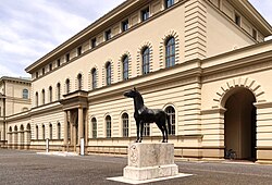
Adresse & Koordinaten · aus Wikidata
Schönfeldstraße 3
80539 München, Deutschland
48.14612, 11.58021 (address)
© OpenStreetMap-Mitwirkende Größere Karte
Bewertung 85 % · production
The building name explicitly refers to the 'Hauptstaatsarchiv' (Main State Archives), and the candidate 'Staatsarchiv München' is the specific Wikipedia article for the Bavarian State Archives in Munich, which houses the mentioned department; although the specific address in the candidate (Schönfeldstraße) differs from the likely location of the 'Kriegsar. Plansammlung' (often associated with the Hauptstaatsarchiv building in the city center or specific archive branches), it is the only relevant
Maschinell aufbereitete Daten
- Kategorie:
- Architektur
- Stadt (normiert):
- München
- Land:
- Deutschland
- Institution (normiert):
- Hauptstaatsarchiv Abt. IV Kriegsar. Plansammlung München 165
- Einrichtungstyp:
- Bibliothek / Archiv
Verknüpfte Bilder
ZI-INVB-THY60-312_01