
Karteikarten (8)
Karteikarte 1 von 8
OCR-Text
–
Ingolstadt
Festung
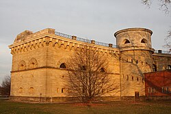
Reduit Tilly
Festung
Reduit Tilly
Außenseite, Blendarkaden
(untere Gebälkzone)
(untere Gebälkzone)
Th 238 576
Foto: Z.I.
72/1476/KB
764
72/1476/KB
764
Extrahierte Daten
- Urheber:
- –
- Ort:
- Ingolstadt, Festung Reduit Tilly
- Titel:
- Außenseite, Blendarkaden (untere Gebälkzone)
- Material:
- –
- Kategorie:
- –
- Inv.-Nr.:
- Th238576
- Fotograf:
- Z.I. 72/1476/KB 764
Kurzinventar · 1
ZI-INVB-KTHY-073 · Inv.-Nr. Th238568 – Th238618
- Herkunft:
- Eigenfotos
- Zugangsart:
- –
- Datum:
- 1972
Datenquelle: manuelle Erfassung Orte · 1
Th238576
- Titel:
- Reduit Tilly
- Titel (Quelle):
- Ingolstadt: Reduit Tilly
- Beschreibung:
- Außenansicht, Fassade, Detail: Blendarkaden
- Urheber:
- Leo von Klenze
- Urheber 2:
- Michael von Streiter
- Entstehung von:
- 1828
- Entstehung bis:
- 1841
- Aufnahme von:
- 1972
- Fotograf:
- Margrit Behrens
- Ort:
- Ingolstadt
- Ort (Quelle):
- Ingolstadt
- Gattung:
- Bauskulptur
- Lizenz:
Geomatch - Verknüpfung mit Normdaten (Orte) · 1
Th238576
Gebäude Objekt / Institution
Adresse & Koordinaten · aus Wikidata
Donaulände
85051 Ingolstadt, Deutschland
48.76007, 11.42936 (street)
© OpenStreetMap-Mitwirkende Größere Karte
Bewertung 100 % · topd-revised
The building candidate 'Reduit Tilly' exactly matches the building name and location (Ingolstadt), and the description confirms it is the specific fortress structure described in the photos.
Maschinell aufbereitete Daten
- Kategorie:
- Architektur KI-Vorhersage
- Stadt (normiert):
- Ingolstadt
- Land:
- Deutschland
- Institution (normiert):
- Festung Reduit Tilly
- Einrichtungstyp:
- Bau / in situ
Verknüpfte Bilder
ZI-INVB-THY65-243_01